
Navigation · ground control · autonomy
DroneSoftware
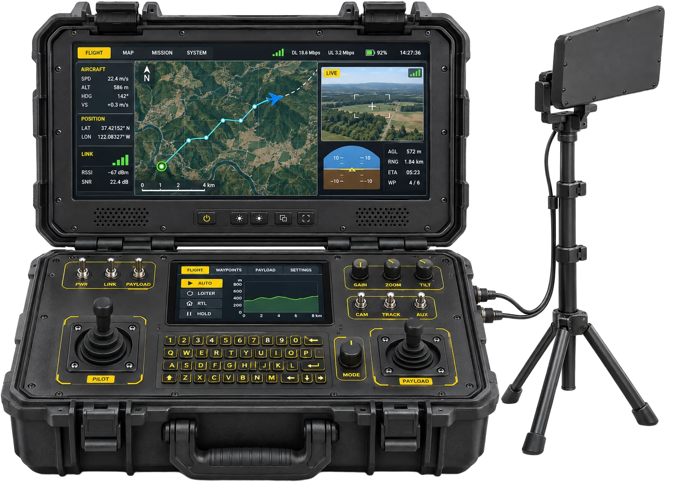
Software written by our own team: visual-inertial navigation that keeps drones flying when GNSS is jammed or spoofed, and a ground control station built in-house for missions, telemetry and fleets.
- GNSS-denied navigation
- Camera + IMU fusion
- In-house GCS
- On-board autonomy
- No satellites needed
At a glance
- < 10 m90th-percentile error
- 2.2 mMedian error, ~1.4 km test corridor
- TRL 5–6Validated in a relevant environment
- < 150 gAdded weight (target)
What we build
Two programmes that fly on Star INXS aircraft: navigation that does not depend on satellites, and the ground station that commands the mission.
Visual-inertial navigation
- Fuses a downward camera with the IMU to estimate position and heading
- Matches camera frames to geo-referenced satellite maps
- Works indoors and outdoors, with or without GNSS
- Heading resolved in under 3 s from a cold start
Made for GNSS-denied operations
- Electronic-warfare zones where GNSS is jammed or spoofed
- Dense urban canyons
- Keeps autonomous flight going when satellites drop out
Drop-in for ArduPilot and PX4
- Position sent to the autopilot's EKF as an external vision source over MAVLink
- No custom flight-controller firmware
- 5–10 Hz updates, 150–400 ms per frame
Ground control station
- Glass-cockpit layout
- Mission planning and navigation
- Live telemetry and weather
- Payload control and fleet management
- Secure command at up to 200 km (PASS)
Light on the aircraft
- Under 150 g of added weight (target)
- Under 12 W of power (target)
Proven in flight
- 2.2 m median error on a ~1.4 km proof-of-concept corridor
- Under 10 m at the 90th percentile
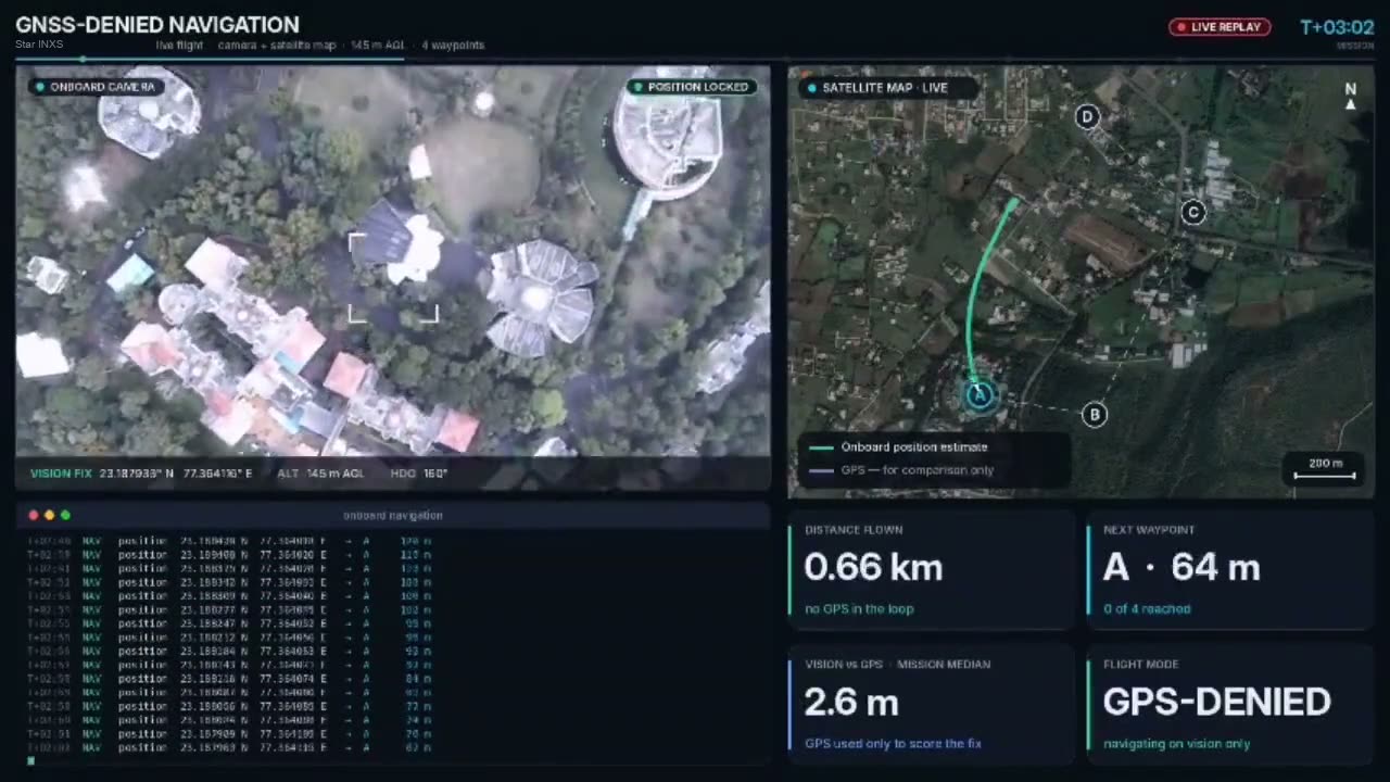
- Flight demo: 2.7 km and four waypoints with no GPS in the loop
Flown without GPS
A replay of a live flight on vision only. The map on the right shows the drone's own position estimate; GPS was logged for comparison, not used to fly.
How it navigates
Every frame, the aircraft works out where it is without satellites.
- 1See
The downward camera captures the ground below.
- 2Match
Each frame is matched to geo-referenced satellite maps.
- 3Fuse
Fixes are fused with IMU data for a stable estimate.
- 4Fly
Position goes to the autopilot's EKF over MAVLink.
Flying with it
Aircraft with our in-house ground control, or visual-inertial navigation as a GNSS backup.
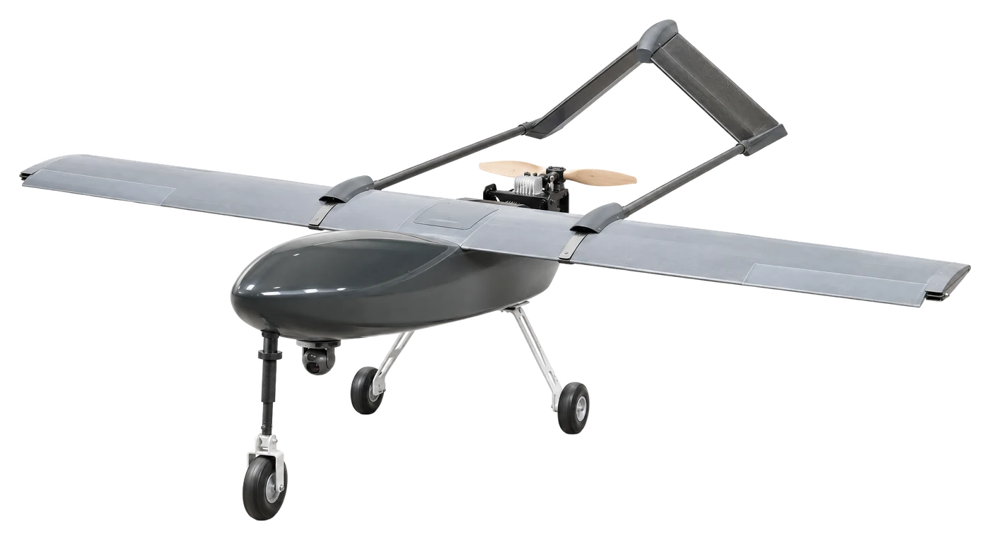
- 360 min
- 200 km comm range
- 8 kg payload
- 6,000 m ceiling
PASS · Police aerial support system, petrol fixed-wing UAV
Police Aerial Support System: a petrol-engined fixed-wing UAV with six hours of endurance, a 200 km command range and short take-off and landing, delivered with our in-house ground control station.
View product →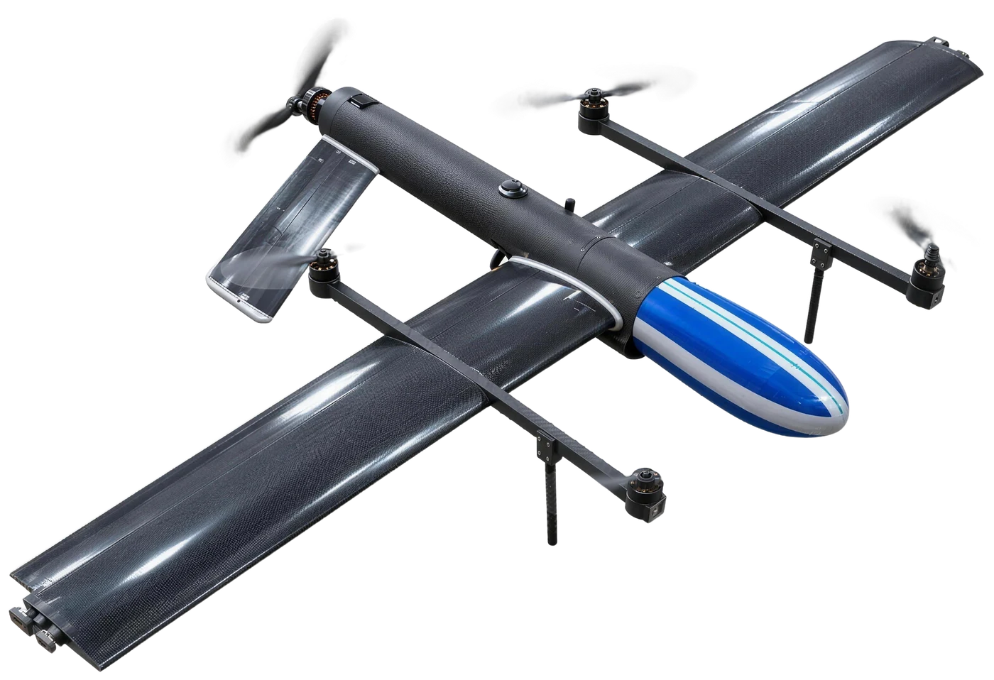
- 7,000 m ceiling
- 60–120+ min
- 5–30 km link
- −30 °C start
Hybrid VTOL · High-altitude tactical surveillance UAV
Vertical take-off with fixed-wing endurance, configured for persistent EO/IR observation in cold, windy and GPS-degraded environments.
View product →More from Star INXS
Related capabilities
- Technology & R&DOn-board AI, navigation, airframes and composites.→
- Ground control & datalinkRugged GCS, anti-jam radio, encryption.→
- Custom & OEM buildsBuilt to your specification.→
- Facilities & labsDesign to fabrication in-house.→
- Training labsTurnkey drone training labs.→
- Systems integrationCommand centres, labs and data centres.→
- ProjectsWhat we deliver, by type of project.→
Common questions
What is visual-inertial odometry (VIO)?
It estimates a drone's position and orientation by fusing camera images with IMU data, so the drone can navigate without GPS.
How accurate is it?
In proof-of-concept tests, 2.2 m median error over a ~1.4 km corridor and under 10 m at the 90th percentile.
Does it need changes to our autopilot?
No. It sends position to ArduPilot or PX4 as an external vision source over MAVLink, with no custom firmware.
How much does it add to the aircraft?
The target is under 150 g and under 12 W.
What ground control comes with your drones?
Our in-house ground control station, with mission planning, navigation, live telemetry, weather, payload control and fleet management. Ground Control & Datalink covers the radio and encryption.
Talk to our team
Talk to our engineers
Need GNSS-denied navigation on your aircraft, or a ground station for your fleet? Tell us the requirement.
- 1 dayResponse time
- GeMTender support
- IndiaDesigned & built
WhatsApp +91 91404 00917 (messages only)
Email contact@starinxs.com